
Cadastral Package
The Cadastral Package allows the assembly of land parcels into a
GIS database. The entry of bearings and distances for each parcel
allows a survey accurate parcel network to be assembled. With the
addition of control points from Trig Survey or GPS, the parcel network
can be adjusted to fit the control.
Because the system stores the original bearings and distances, these
can always be used in the network adjustment to achieve the highest
possible accuracy for the network co-ordinates.
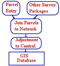
The assembly of a cadastral network has been broken into three stages:-
Parcel Data Entry
The data entry program is designed for use by personnel with
good keyboard skills, but little or no surveying knowledge.
Operators may key in data as it appears on the plan. As each
line is entered the parcel is drawn in a window on the right
of the screen.
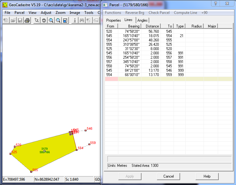
Dimensions can be entered as shown on the plan in feet and inches,
links or metres. Bearings can be enter in a variety of formats.
The function keys can be used for specific tasks such as
reversing a bearing, recalling a previous line, inserting lines
and deleting lines.
Parcel Joining
The parcel joining process requires an operator with some
knowledge of the cadastre, and survey plans in general. The
screen is divided into three windows, with the main window
holding a picture of the parcels joined to date, a second
window to the right has a picture of the next parcel to be
joined in, and thre third is a menu area.
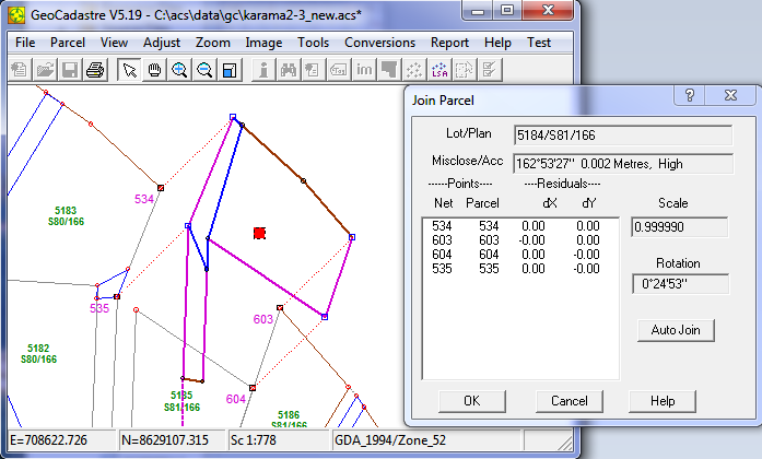
Join points and lines are selected by mouse and the join
details are displayed in the menu window. Zoom and Pan is
available in both drawing windows, and the data entry screen
can be recalled to edit any parcel before joining.
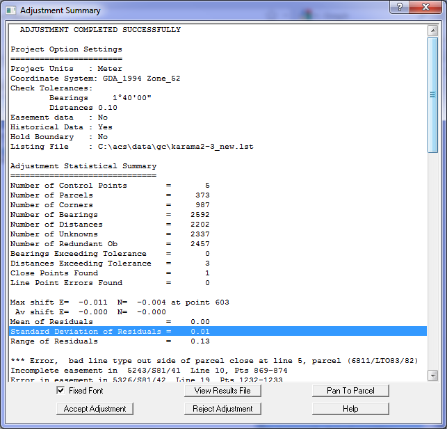
Network Adjustment
The adjustment is performed from parcel data and control points.
It automatically weights the data according to the date of the
plan. The adjustment program produces a listing file showing all
lines, errors on lines and co-ordinates for all points.
It is a least squares adjustment by the variation in
co-ordinates technique, and can conveniently handle 200-300
parcels at a time.
Three Stage Quality Control
As each parcel is entered, the parcel is closed,
the error ratio and area are checked. Most data entry errors can be
detected and fixed at this stage.
As parcels are joined to the network, they are rotated, scaled and
shifted to fit into the network. The fit error at each joined
points is shown, he operator can accept the parcel or reject it and fix
the source of the error.
When the parcel network is adjusted, the fit is
computed for each parcel. All parcels with an error of
more than two (2) standard deviations from normal are listed in a
special table at the end of the adjustment listing.
Co-ordinates
It is important to carefully consider the role that co-ordinates will
play in the digital cadastral system. Co-ordinates are only temporarily
derived quantities which can change as more data becomes available.
They are simply another form of dimension, and as such are subject to
revision as further measurements are taken, or when an adjustment
of the
data provides a more likely estimate of the positions of points.
If the cadastral record system is based on vector data and control
points,
then co-ordinates can be produced as needed, and co-ordinate values
will progressively improve in accuracy as new data is added. It is
important to view co-ordinates as simply being derived information,
not the base reference material itself.